"Moreton Shire & Pumicestone Passage:
City & Wilderness in Harmony"
&
"The Pocket Books Office Move"
Ten years ago I read about the Pumicestone Passage being referred to as a great 'wilderness area'. A wilderness denotes a lot more than just an animal reserve or a national park. More investigation found that this particular 'wilderness' could be called the closest wilderness to a captial city anywhere in the world. The old shire of Caboolture, and the amalgamated shire of Moreton certainly do have esomething to sing about.
That's why I developed the slogan, first for Caboolture and now for Moreton, which we use on our back cover: "Moreton Shire & Pumicestone Passage: City & Nature in Harmony".
Perhaps 'nature' has been a little obscure in this context, so I am changing the word 'nature' to the word 'wilderness' for the slogan.
I do laugh a little bit at the offical Moreton Shire slogan of 'where lifestyle really counts' as any shire could use this, even if factory chimneys dominate their skylines. But no other shure can use Moreton Shire & Pumicestone Passage: City & Wilderness in Harmony".
The Pumicestone Passage winds from the Bribie Island Bridge, which celebrated its 50th year in 2013, through Toorbul, Meldale, Donnybrook, Banskia Beach, White Patch, Welsby right up to Caloundra.
The passage was orginally shown as Pumice-stone River on the maps of Matthew Flinders as he found an abundance of pumice stone lining the shoreline. He was the first European explorer to enter Moreton Bay in 1799 on the Sloop H. M. 'Norfolk' and spent two weeks exploring the bay and surrounds. He named Point Skirmish on Bribie Is and Pumice-stone River (Wikipedia).
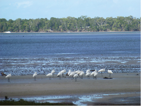
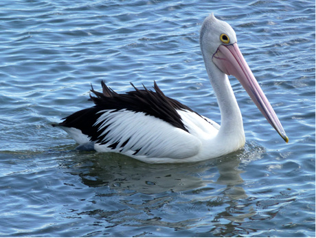
The Pumicestone Marine Park has an area of 63sq km, a shoreline of 240km and contains 24 islands. There are over 350 species of birds, as well as dolphins and dugongs. Eighty per cent of the water is under two metres deep.
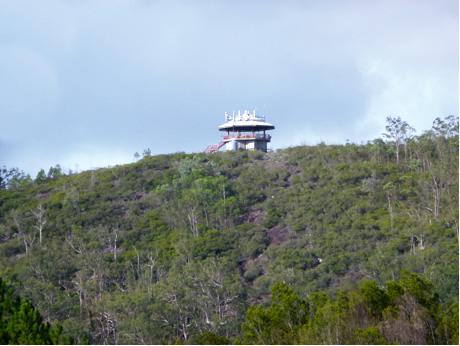
First step to take these photo was for me to jog up to the top of the 123m high Wild Horse Mountain, just near Johnson Rd on map 342 H5. That replaced my 5km run for the day!
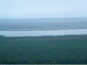
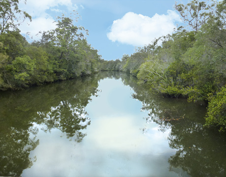
Here is the view. This is the Pumicestone Passage looking East from the Wold Horse Mountain lookout.
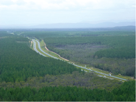
This is the Bruce Hy looking South from the Wild Horse Mtn lookout, showing that we do live in harmony with the wilderness.
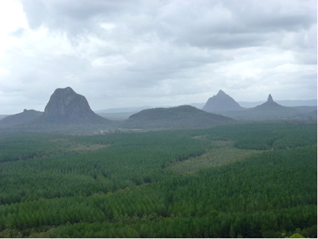
This is the Glass House Mountains looking west from the Wild Horse Mtn lookout, with Tibrogargan map 341 F3, Beerwah and Coonowrin map F A7. The rains from these mountains help create the run-off waters into the Pumicestone Passage.
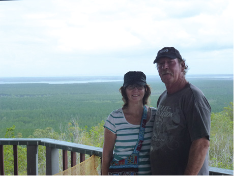
These visitors from Toowoomba also climbed Wild Horse Mtn. They looked across at Mt Beerwah. I had to inform that the path to the top is still closed, but I said I would chat with Andrew Powell, the local member and environment minister, whom I would see at a meeting that very evening, Fri 31st Jan 2014. Andrew said he gets many requests and would also like to see the path open.
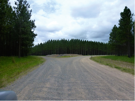
The pine plantations on the Donnybrook Rd alongside the Pumicestone Passage again show some co-operation between wilderness and the city. Map H D2. 58.
I just missed a photo of a dozen wild horses a few hundred metres past this corner. Perhaps Wild Horse Mountain has a reason for its name.
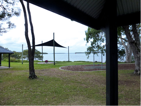
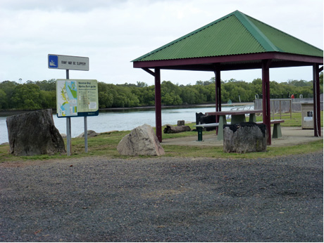
Donnybrook has this delightful bar-be-que picnic area with some play equipment, with views to the Passage and some of its islands. Map 374 G6.
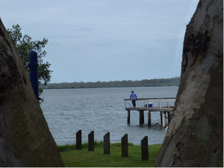
This chap from Ipswich was enjoying the fishing. Map 374 G6. He said he would love to move to Caboolture, but his wife has established a garden at Ipswich. I said to him to get the weather information from Pocket book and the Bureau of Meteology to compare Ipswich and Caboolture, especially Donnybrook and Bribie Island. We have occasional hot days, but not long spells of 36° and 40° heat. The comparison should convince the missus that having a fruit tree and vegetable garden in the Caboolture area will be much easier than at Ipswich. He happily took a Caboolture Pocket Book back to Ipswich.
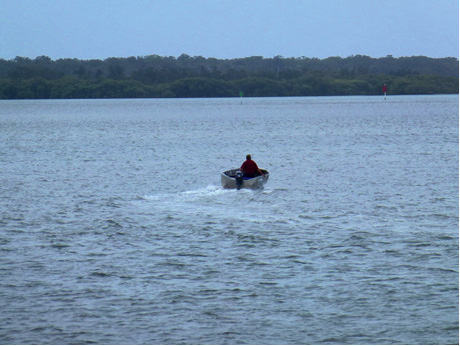
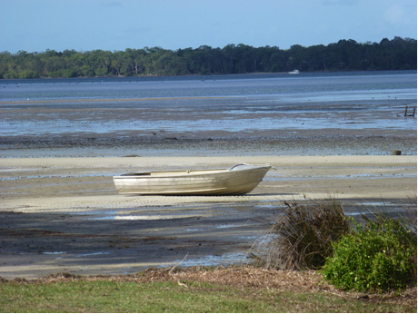
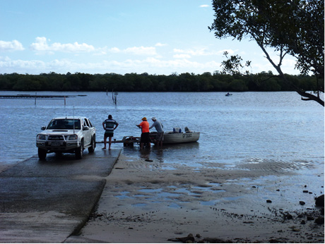
Another fisherman enjoying the quiet waters of this wilderness passage. Map 374 G5
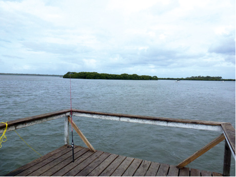
An island, boat & fishing rod at the Passage off Donnybrook.
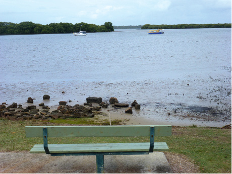
Along the southern esplanade at Donnybrook at Pioneer Park, this is a 'seat with a view'. Map 374 G7.
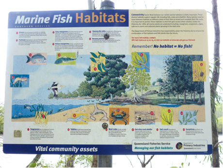
This Department of Primary Industries & Fisheries sign briefly explains the importance of the Passage within our environmental system.
The water flow between various habitats supports aquatic life such as fish, crabs and shellfish, which move between saline and freshwater areas to breed and complete their life cycles. Within the tidal zone the government seeks to protect all marine plants including mangroves, seagrasses, algae and saltmarsh.
From the sign, animals, fish and plants that can be found in Pumicestone Passage are:
1. Bream, Acanthopagrus australis, are common throughout the state, but mainly caught from the Qld-NSW border north to Fraser Is. (see www.pocketbooks.com.au, Hervey Bay - Maryborough Pocket Book for Fraser Is.)
2. Flathead, Platycephalus species; the coastal estuaries have several flathead species suitable for fishing.
3. Grey mangroves, Avicennia marina, are the most widely distributed mangrove species in Australia. In southern Qld, grey mangroves often form thick fringing stands on the seaward edge of bays & estuaries, extending up tidally influenced rivers, streams and drains.
4. Yellow mangroves, Ceriops species, are also quite common in southern Qld, often occuring as short stunted trees in heavily salted water environments, but growing to a height of 5 metres
where freshwater has some influence.
5. Swamp she-oaks, Allocasuarina glauca, are also known directly from their Latin name as casuarinas. These are not true mangroves, but often grown in association with yellow mangroves in tidal areas.
6. Banana prawns, Fenneropenaeus merguiensis, live on muddly bottoms along the Qld coast.
7. Seagrasses provide food and shelter for fish, crabs and prawns, while trapping sediments and stablising the sea bed. Eel grass, Zostera capricorni, is fairly common in southern Qld estuaries & bays.
8. Yabbies, Callianassa species, are small shrimp-like crustaceans found living in Australian intertidal mud and sand flats in estuaries.
9. Mud crabs, Scylla serrata, live along the length of the Qld coast, in estuaries, tidal flats and mangrove areas.
10. Hercules mud whelks, Pyrazus ebeninus, grow to 90mm; they graze in huge numbers on the estuary mudflats & mangrove swamps.
11. Salt couch, Sporobolus virginicus, grows in dense mats in the upper tidal areas of horelines, on salt flats, marshes and margins behind mangrove forests.
12. Samphires are fleshy low growing plants that occur on salt marshes behind the mangrove fringe.
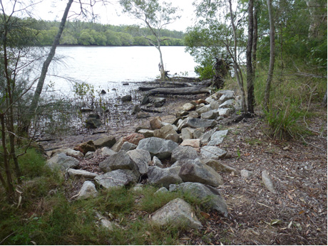
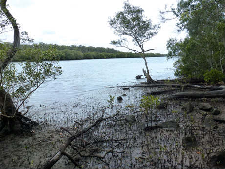
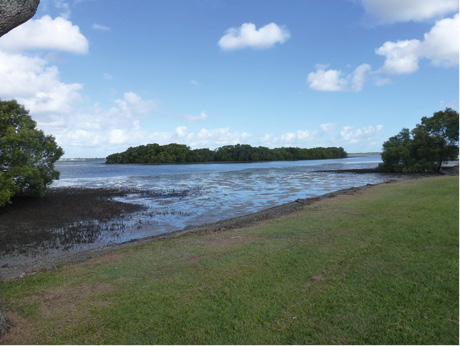
The rocks and mud provide the habitat for many of these animals, on the way into eldale. Map 390 F6.
The Bullock Creek Esplanade is almost untouched by human hands, apart for the lonely rubbish bin at map 390 G4. It has the above view and enjoys the fish. The few homes along here have a quiet solitude, emulating city and wilderness in harmony.
Meldale's Way St, map 390 H7, has picnic facilities and a boat ramp. Lucky are the few Way St residents with private access direct to the Elimbah Creek estuary.
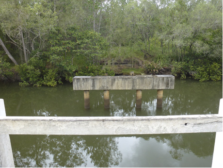
The bin on old Donnybrook Rd, map 390 A5, is another little fishing spot. Opposite here on Donnybrook Rd is part of an old bridge accessible over Elimbah Creek, only from Donnybrook Rd.
This part of Elimbah Creek viewed NE from the old bridge is a quiet oasis.
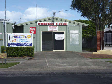
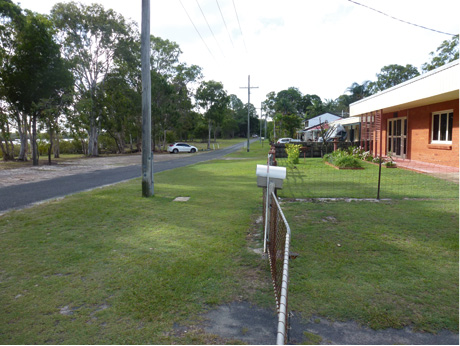
One knows when city meets wilderness when a village fire brigade appears. This is Toorbul at Freeman Rd, map 391 D6.
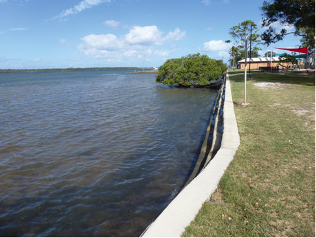
The Toorbul foreshore with picnic and play area.
A pleasant Toorbul Sunday afternoon out crabbing.
The Toorbul bird life on the southern esplanade near the BBQ on map
Part of living in harmony with wilderness is helping waterbirds which may be affected by urban development. Waterbirds need roosting areas above high water mark or high tide mark. Sometimes they will not roost too close to housing or development, and consequently are forced to fly elsewhere. As often these are migratory birds, which use one-third of their weight for the energy for their flight, so an extra forced flight is difficult.
On the Eastern side of Pumicestone Passage, at Kakadu, Banksia Beach, map 412 C2, a man-made roost has really helped the birds. The building of this roost has prompted another roost to be built at Toorbul, map 411 G4.
This Toorbul tinny awaits its master.
Perhaps he will take his tinny across to the island.
Moffat Esp at Toorbul, map 411 D4, is one of those little gems which is easily missed. The dozen homes have a tranquil wilderness existence just an hour from bustling Brisbane.
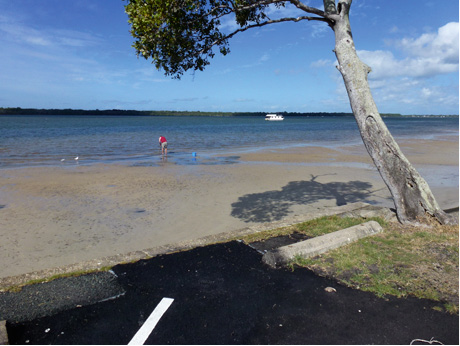
These visitors from Ipswich have surely discovered the Moffat Esp gem. The view is to Ningi island across the Ningi estuary, which is the southern part of the Pumicestone Passage area.
This fellow was calmly swimming along Moffat's mudflats, just off the small jetty at the northern end of the hamlet. (Photo 624) I think he is indicating that "Moreton Shire & Pumicestone Passage: City & Wilderness in Harmony".
The Pumicestone Passage does go right up to Caloundra. Caloundra is where the city meets the wilderness.
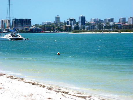
The above is not from the Carribean. This is a photo of 'today's Caloundra' with a skyline of units, commercial building and resorts enjoyed by many from around the World. I developed a slogan for the area in 1997 of "Caloundra - the Beach City of Champions". A city that has eight beaches and was full of champions of sport, business and music who live or retire here. See map 286. (Caloundra lives in harmony with its piece of the Pumicestone Passage wilderness.
The Pocket Books Office Move
This Caboolture Pocket Book has reached its 24th annual edition. Our firm of Pocket Books started in Kew Melbourne 24 years ago, in 1990, with Bacchus Marsh in Victoria as the first book, closely followed by Caboolture in Qld. In 1992 we moved the office to Miles Qld, then in 1995 to Currimundi, and in 2003 to Beerwah. In Dec 2013 we have returned the office to the coast by buying a building that suits us perfectly at 8 Otranto Av Caloundra, cnr Farlow Ln, map 286 B4 - C4, just around the corner from Subway.
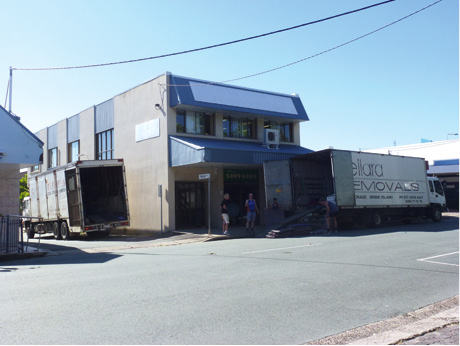
Jack from Caboolture's Bellara Removals completed the move in just one day. His 60 cu m truck and his 45 cu m truck were both jam-packed with desks, computers and equipment for our twelve staff. When Jack insisted on leaving 300 boxes at our office, I never dreamt we would need even a hundred. Well …
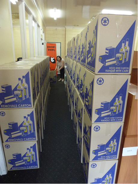
Nevenka is presenting some of the 254 boxes, just before truck loading, at Beerwah.
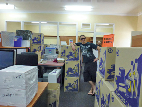
… and Stuart, graphic designer, at Beerwah, obviously preparing for the holiday mood of Caloundra.
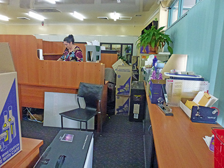
... Raylee, using her 'overseeing' skills during the move.
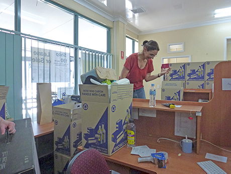
... Carole used her packing skills to the hand-fill the majority of the 254 boxes needed for the move.
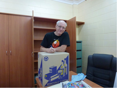
... and me, packing boxes.
Gerry Clarke B. PED